Project Description
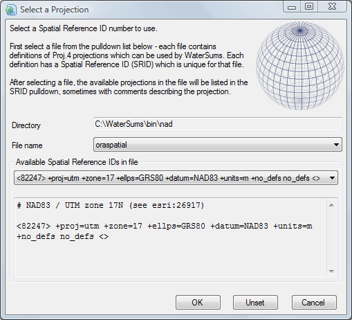
WaterSums uses the Proj.4 cartographic projections library internally and provides a panel for selecting from the available projections.

WaterSums uses the Proj.4 cartographic projections library internally and provides a panel for selecting from the available projections.