
Project Description
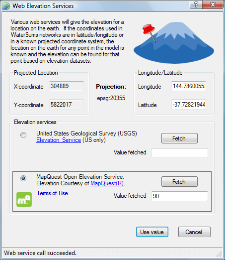
WaterSums can now provide access to web elevation services to help with confirming elevations of nodes (junctions, reservoirs and tanks) in network models. Once an elevation is fetched from a web service, it can be directly applied to the selected node. Note that there is no implied support for WaterSums from any web service providers – WaterSums simply consumes the generously provided web services. Users must ensure that they use the services within the terms and conditions specified by each provider. WaterSums also makes it easy to check the conditions by providing links within the software.