
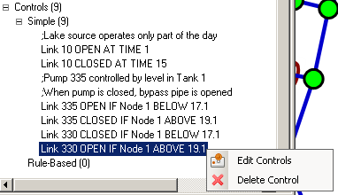
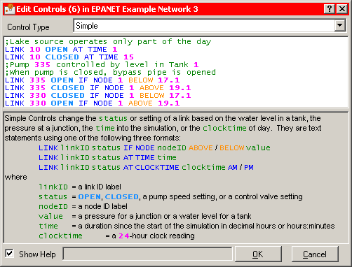
Controls mandate the behaviour of links (pipes, pumps or valves) based on time or other conditions in a network. Simple Controls have a very simple syntax while Rule-based Controls can be much more complex. The text of each Control is displayed in the Project Tree and a context menu allows them to be edited in [...]
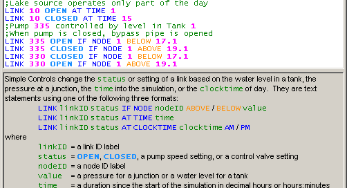
Control Editor
admin2017-03-25T23:23:06+11:00Controls are edited in the Control Editor which displays the text of all controls with syntax highlighting and auto-completion. Syntax is checked as the user typed and references to network objects are also checked to make sure that they exist.
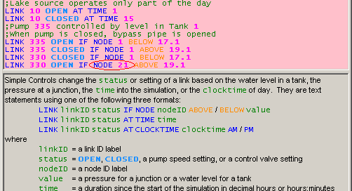
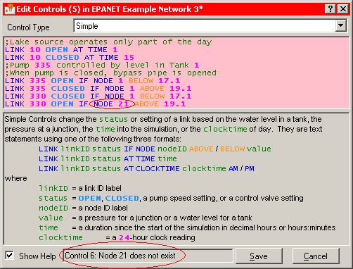
Control Editor (with error)
admin2017-03-25T23:23:06+11:00Controls are edited in the Control Editor which displays the text of all controls with syntax highlighting and auto-completion. Syntax is checked as the user typed and references to network objects are also checked to make sure that they exist. If a syntax error or a reference to a missing object is detected, the background [...]
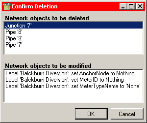
Deletion and refential integrity checks
admin2017-03-25T23:23:06+11:00Referential integrity is important. Whenever a network object refers to another object, WaterSums must ensure that the object really exists. Sometimes, when items are deleted, other items may be depending on them: for example a link will depend on a start node and an end node. Deleting the node requires that any links which depend [...]
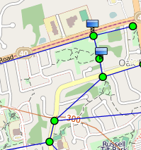
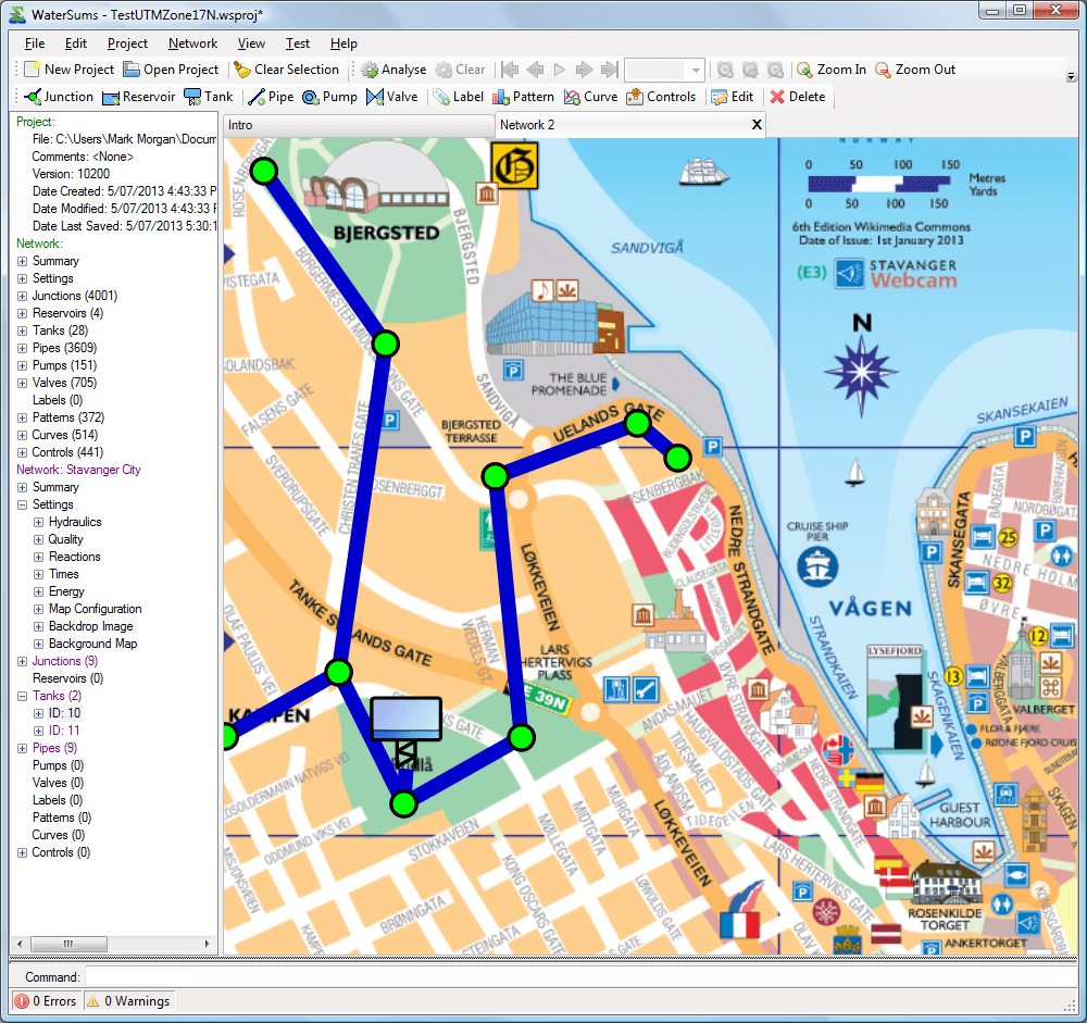
Network with OpenStreetMap (© OpenStreetMap contributors) displayed in the background
admin2017-03-25T23:23:06+11:00A small example of a network with OpenStreetMap in the background. OpenStreetMap maps are available under an open licence, so WaterSums can display these maps without any extra licence fees or complexity. We satisfy the compliance requirements by including in the background map an acknowledgement of the OpenStreetMap contributors and their valuable work. CloudMade maps [...]
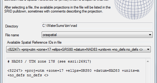
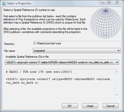
Projection Selection panel
admin2017-03-25T23:23:06+11:00WaterSums uses the Proj.4 cartographic projections library internally and provides a panel for selecting from the available projections.
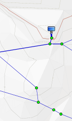
Automatically generated terrain shading
admin2017-03-25T23:23:06+11:00WaterSums can automatically generate terrain shading based on the elevations given in a network model for junctions, tanks and reservoirs. This process is experimental at the moment, but can help significantly with the visualisation of the comparative elevations and slopes in a network.
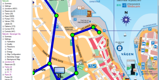
Network with a backdrop image
admin2017-03-25T23:23:07+11:00Backdrop image shown in WaterSums showing how network can be digitised on top of a map. The backdrop image is a map of Stavanger City in Norway by Kevin Paul Scarrott. This picture is licensed under a Creative Commons Attribution-Share Alike 3.0 Unported license.
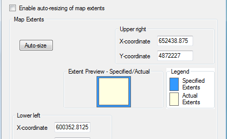
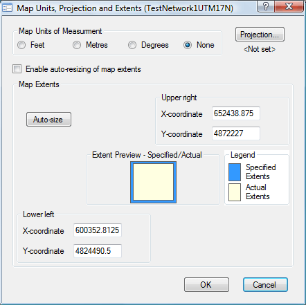
Units, Projection and Extents panel
admin2017-03-25T23:23:07+11:00WaterSums allows the flexibility of choosing different levels of complexity for different applications. If arbitrary coordinates are to be used for locating network objects, the units of measure and extents of the network can be specified. The network layout can then be matched to a backdrop image to allow digitizing of network locations. In this [...]
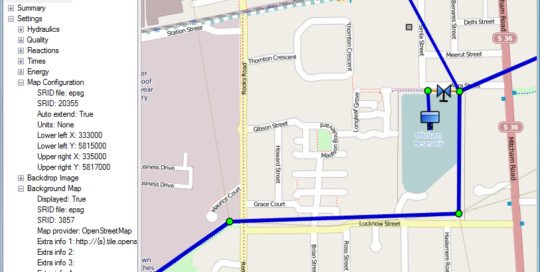
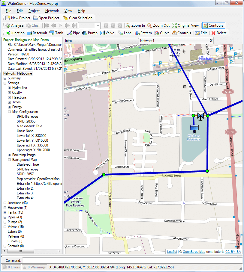
WaterSums Demo Project
admin2017-03-25T23:23:07+11:00MapDemo.wsproj Points of note OpenStreetMap (© OpenStreetMap contributors) background map of Melbourne, Australia. The network map configuration is shown in the project tree including the projection information (file: epsg, SRID: 20355). Background map configuration information is shown in the project tree: background maps will be displayed using OpenStreetMaps. Pipe thickness and tank symbol size indicate [...]