
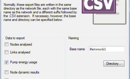
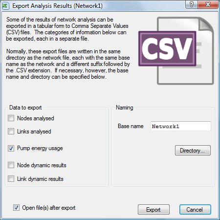
Exporting Analysis Results to CSV files WaterSums uses the EPANET toolkit to analyse a water supply network. The results can then be exported to several Comma Separated Values (CSV) files and displayed immediately if desired.
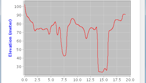
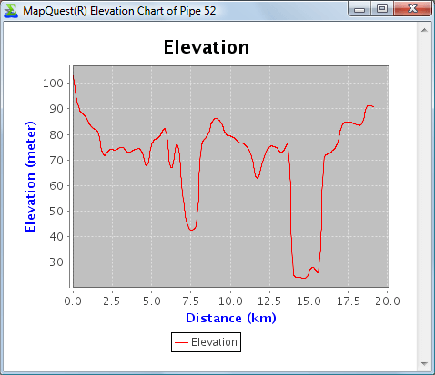
Pipe Elevation Chart (courtesy of MapQuest Open Elevation Service)
admin2017-03-25T23:23:44+11:00An elevation chart courtesy of MapQuest Open Elevation Service. The chart is generated on demand by the MapQuest service based on WaterSums providing the start and end location of a selected pipe as well as various midpoints. WaterSums then displays the chart in a browser window. Note that MapQuest generously provides the service: there is [...]
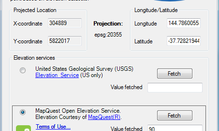
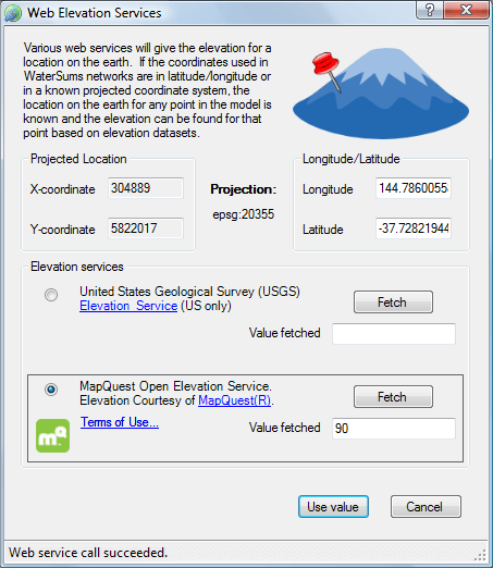
Web Elevation Services
admin2017-03-25T23:23:44+11:00WaterSums can now provide access to web elevation services to help with confirming elevations of nodes (junctions, reservoirs and tanks) in network models. Once an elevation is fetched from a web service, it can be directly applied to the selected node. Note that there is no implied support for WaterSums from any web service providers [...]